In a nutshell
- The peninsula sits 136 km (85 mi) from Reykjavík, roughly a 2-hour drive via Route 1 and Route 54.[1]
- Snæfellsjökull is a glacier-capped stratovolcano 1,446 meters high inside Snæfellsjökull National Park, established in 2001.[2]
- Kirkjufell stands 463 meters (1,519 feet) high and is one of the most photographed mountains in Iceland.[3]
- The From Reykjavik: Snæfellsnes Peninsula Full-Day Tour is listed from US$145, lasts 11 hours and is guided in English.[4]
- The full-day tour is rated 4.72 from 3,765 reviews, with guide scores of 4.8 and value for money at 4.6.[4]
- Top choice Full-Day Peninsula Tour from US$145 Duration11 hours[4]Rating4.72 from 3,765 reviews[4]Guide languageEnglish[4]PickupCheck availability for pickup options[4]CancellationCancel up to 24 hours in advance[4] Check availability
- Premium Minibus Tour from US$161 Duration11 hours[5]Rating4.77 from 789 reviews[5]Guide languageEnglish[5]PickupCheck availability for details[5]CancellationCancel up to 24 hours in advance[5] See this tour
- Small-Group Peninsula Tour from US$138 Duration12 hours[6]Rating4.60 from 478 reviews[6]Guide languageEnglish[6]PickupCheck availability for details[6]CancellationCancel up to 24 hours in advance[6] See this tour
Guided by Summit Adventure Guides , the sole licensed operator of Vatnshellir Cave tours, you'll embark on a 45-minute journey into this natural wonder.
Is the full-day peninsula tour worth it?
Getting there and around
A Volcanic Spine Built in Layers
Stand on the south coast of the peninsula and the land reads like a stack of pages. Snæfellsnes is a long ridge of volcanic rock, built up by eruption after eruption during the last ice age and in the quieter periods between. Some layers are hard, dark basalt that cooled slowly in thick flows. Others are softer, made of ash, breccia and shattered rock that later eruptions, waves and ice have worn back. The result is a spine of higher ground running west into the Atlantic, with farmland, lakes and beaches on either side.
The ridge is crowned by Snæfellsjökull, a glacier-capped stratovolcano 1,446 meters high, and the mountain sits inside Snæfellsjökull National Park, established in 2001.[2] Snæfellsjökull, the peninsula's ice cap, is the landmark everything else is measured against. Farms, roads and viewpoints all orient themselves towards it, and the ice on top feeds the streams that drain down to both coasts.
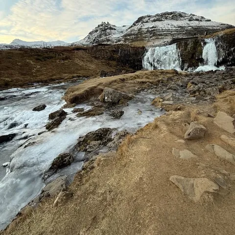
Volcanic layers like these are easy to read once you know what to look for. Dark, columnar cliffs are cooled lava that contracted into pillars as it set. Reddish bands are rock that later heat cooked and oxidised. Soft, yellowish palagonite forms when lava erupts under ice or water and shatters as it cools. You pass that mix again and again along the peninsula, which is why the place works so well as a short course in how Iceland was built.
Glacial Carving and the Fjords of Grundarfjörður
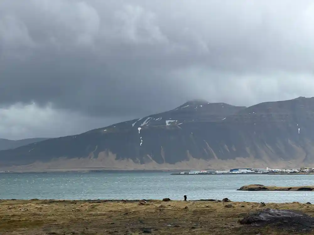
Ice did the next stage of the work. A thicker ice sheet once covered this coast, and as it crept forward it ground down the softer rock, widened valleys and left harder lava flows standing as ridges and headlands. Where the ice reached the sea, it carved the bays and narrow inlets that now shape the north coast, including the water around Grundarfjörður. The sharp peaks that frame the town are the leftover bones of that process, rock the ice could not remove.
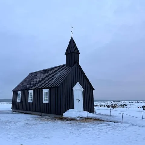
When the ice pulled back, meltwater kept working along the same lines. Streams cut gorges, waterfalls dropped over hard ledges, and moraines of mixed rock and gravel piled up at the mouths of valleys. Much of the low, green ground you cross by road today is this glacial debris, smoothed out and farmed. Look at the size of the boulders in a hillside fence line and you are looking at material a glacier once carried.
On the road, the shape of the land tells you which way the ice went. Long, smooth slopes face the direction of flow; steep, broken faces look the other way. Fjord walls rise almost straight from the water because the ice cut them quickly and the sea kept them clean. It is worth pulling over somewhere safe on the north coast simply to watch how the ridges repeat, one after another, all pointing the same way.
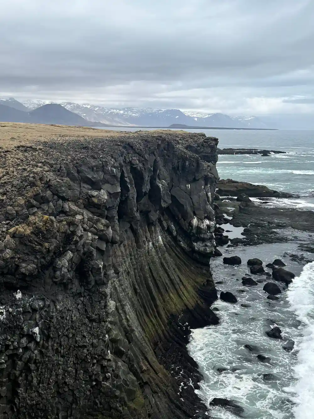
Layered cliffs, black pebbles and a glacier on the skyline: the peninsula in one view.
Black Sand and the Chemistry of Basalt
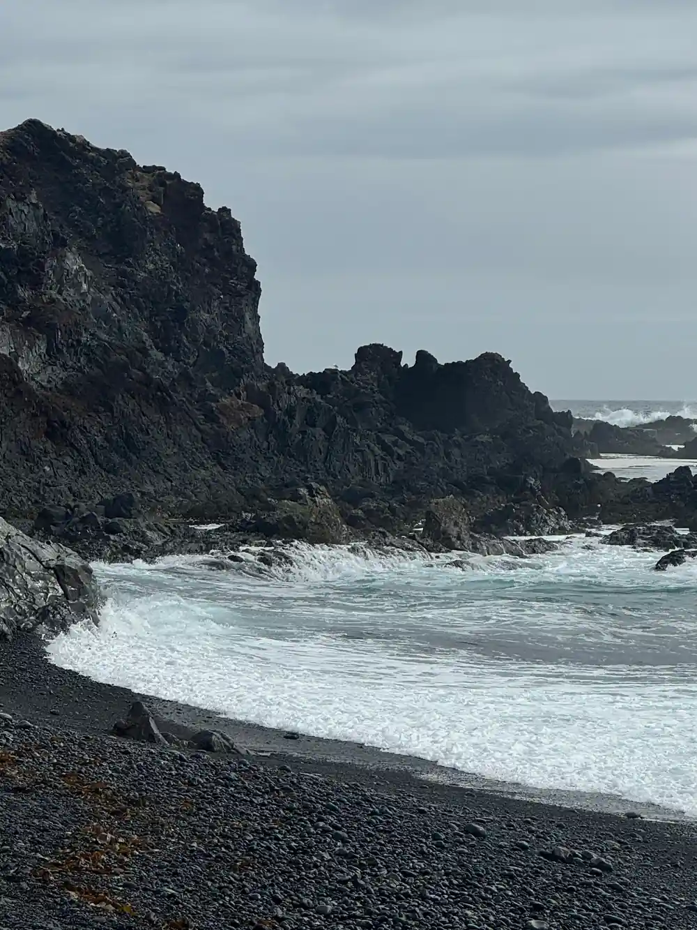
Basalt is the reason so much of Snæfellsnes is dark. It is a low-silica lava rich in iron and magnesium, which is why it sets almost black and weathers to grey. Break a piece and the fresh surface is fine grained, sometimes with tiny crystals or gas bubbles frozen in place. Over centuries, frost, salt spray and waves break this rock down, and the hard minerals that survive become the black sand and pebbles that give the peninsula's beaches their colour.
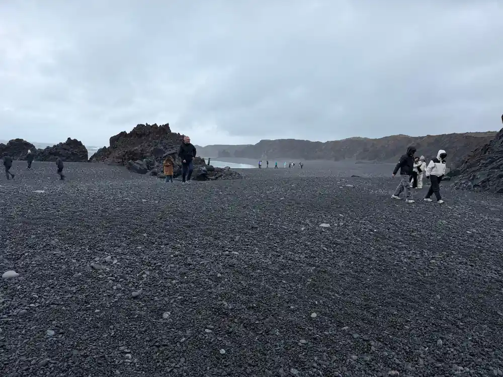
Djúpalónssandur is the best known of them. It is known for its four historic lifting stones, the remains of the British trawler Epine GY7 wrecked here in 1948, the natural rock arch Gatklettur, and its black pebble beach at the foot of Snæfellsjökull glacier.[10] The wreckage is part of what the beach is known for, alongside the stones and the arch.
Pebble beaches like this are sorting machines. Waves roll stones back and forth, and each tide leaves the roundest, heaviest ones higher up the shore. That is why the lower beach is coarse and wet and the storm ridge above it is packed with larger cobbles. Walk carefully, keep off the wet stones near the water and never turn your back on the surf.
Kirkjufell and Layered Basalt Formation
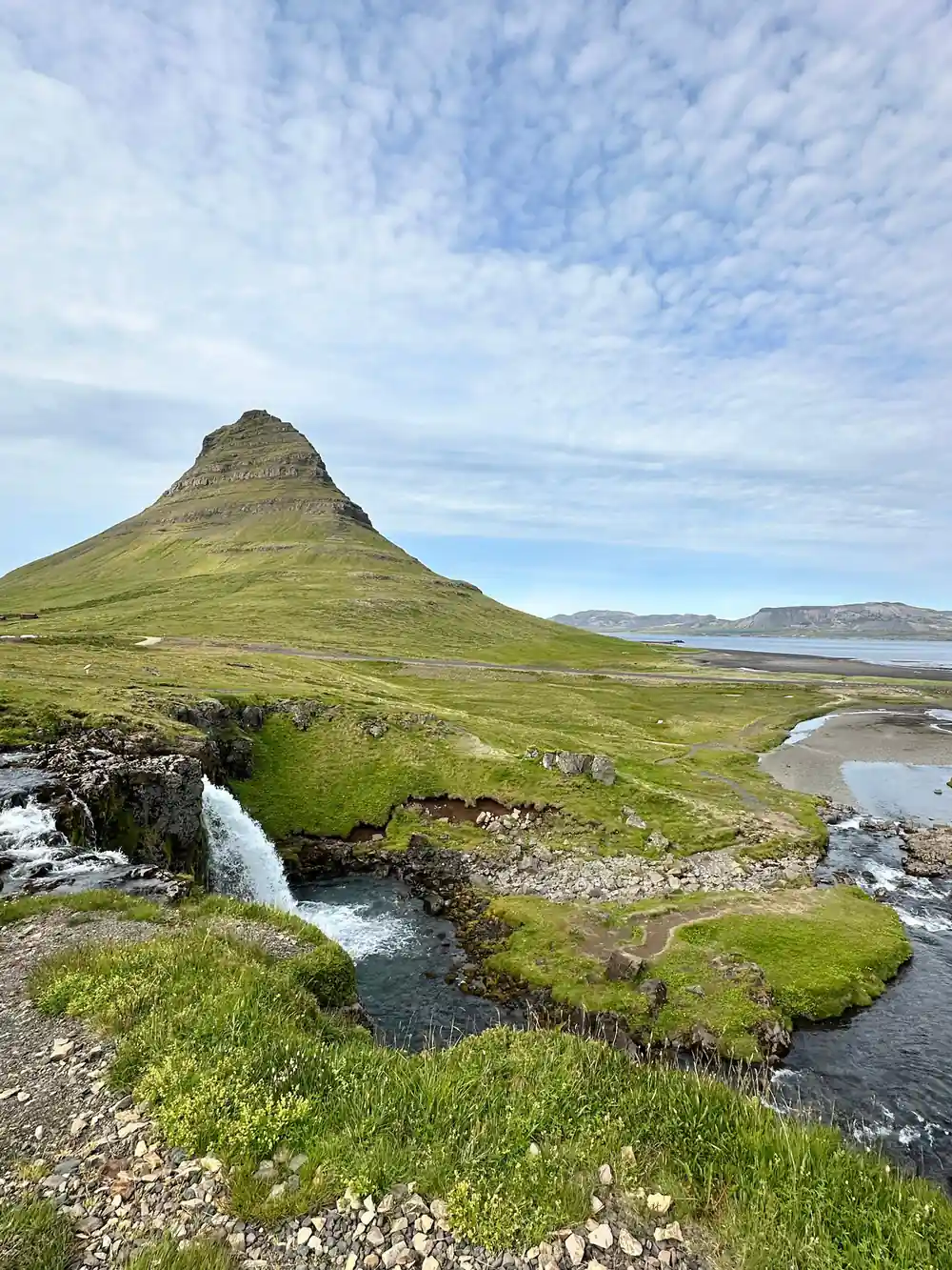
Kirkjufell is the shape most people picture when they think of the peninsula. It is a mountain in Iceland that stands 463 meters (1,519 feet) high and is one of the most photographed mountains in Iceland.[3] From the road beside Grundarfjörður it looks like a cone with a tilted hat, and its profile changes completely as you drive around it.
The mountain is built of layer upon layer of lava and loose volcanic material, stacked up and then trimmed by ice. Its odd silhouette comes from that combination: softer beds eroded back on one side, harder flows left standing on the other. The same story repeats in miniature in the small cliffs along the shore, where you can trace individual beds with your eye from the car park.
Photographers tend to arrive in the evening, when the light comes in low from the west and the layers show clearly. Moss and grass pick out the softer bands in green, while the hard rock stays dark. A short walk to the nearby waterfall gives you the classic foreground, with the mountain behind and the water in front. Give yourself time here rather than treating it as a quick photo stop.
136 km
The Snæfellsnes Peninsula sits 136 km (85 mi) from Reykjavík, roughly a 2-hour drive via Route 1 and Route 54.[1]
Coastline Rhythms: Cliffs and Beaches in Sequence
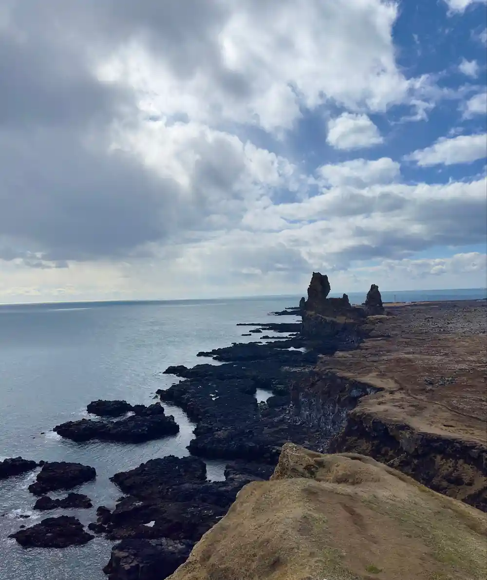
Londrangar is where the coastline becomes dramatic. Black basalt plugs stand out of the sea on a short headland, with the cliffs of the national park behind them. Puffins, guillemots, fulmars, and kittiwakes nest at Londrangar from late spring to summer.[11] Bring binoculars, keep back from the edge, and give the birds space, especially where the grass is worn thin and the drop is close.
Just along the coast, the walk between Arnarstapi and Hellnar is a small hiking trail that starts very close to the Bardur statue in Arnarstapi, and it is an easy walk that takes about 2 hours return along the coastline.[9] It is a good way to see basalt columns, rock arches and the seabirds that live there, and the path is gentle enough for most walkers. Weatherproof shoes help, because the surface is uneven and often damp.
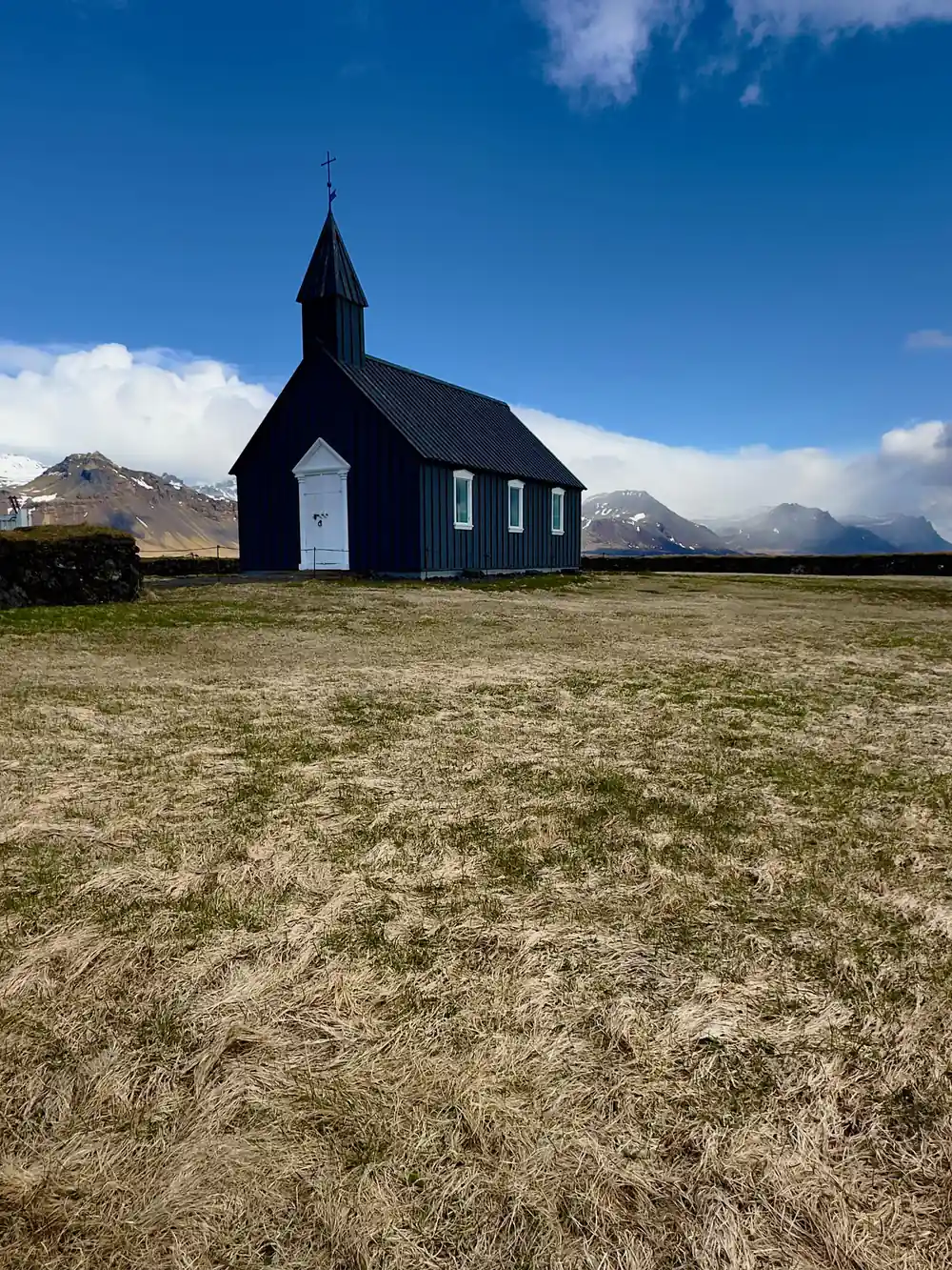
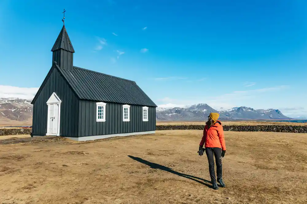
Arnarstapi is also where the saga landscape sits beside the road. According to Bárðar Saga Snæfellsáss, Bárður Snæfellsás was the settler of the Snæfellsnes area and was half a troll and half a man, his father being half a titan and his mother human.[12] Further south, Búðakirkja is a small wooden church on the south side of the Snæfellsnes Peninsula in Iceland.[13] The dark timber against pale grass is a favourite stop for photographs, and the old walls around it are worth a slow walk.
Why Snæfellsnes Is Called Iceland in Miniature
Distance is part of why the peninsula is so easy to add to a Reykjavik trip. The Snæfellsnes Peninsula sits 136 km (85 mi) from Reykjavík, roughly a 2-hour drive via Route 1 and Route 54.[1] If you are asking how far is Snaefellsnes Peninsula from Reykjavik before you decide whether to go, that is the answer: close enough for a long day out, far enough that you leave the city traffic behind.
What you get for the drive is range. In one day you can pass a glacier, a lava field, a black pebble beach, bird cliffs, a fishing village, a turf farm and a wooden church. The Snæfellsnes Peninsula in West Iceland packs those into one long ridge, which is why the nickname fits. The peninsula does not need scale to be memorable; what it offers is variety within reach.
That variety comes from the geology. Volcanic layers, glacial carving, sea cliffs and beaches are all part of the same story, and the peninsula is small enough to read the whole sequence in a day. Guides often describe it as a miniature Iceland for that reason, and once you have seen the glacier above the black sand and the columns above the sea, the comparison makes sense.
What to Observe on Your Visit
If you would rather let someone else drive, the From Reykjavik: Snæfellsnes Peninsula Full-Day Tour is listed from US$145 and lasts 11 hours, with live guiding in English.[4] Pickup is available; check availability for pickup options.[4] The route takes in Vatnaleið, Kirkjufell, Ólafsvík, Djúpalónssandur, Londrangar, Arnarstapi, Búðakirkja and Ytri Tunga.[4] You can reserve now and pay later, and free cancellation is offered up to 24 hours in advance for a full refund.[4]
Side stops can fill the gaps in your day or a second day on the peninsula. The guided Vatnshellir lava cave tour lasts 45 minutes.[8] Lýsulaugar has geothermal baths including two hot tubs, a large geothermal swimming pool, and a cold tub.[14] Whale watching on Snæfellsnes is run from Ólafsvík.[15] Stóri-Kambur offers horse riding tours that take riders into the heart of Snæfellsnes in West Iceland.[16]
Whatever you plan, dress for a coastal peninsula rather than a city day. Layers, a waterproof outer shell and shoes with grip cover most weather, and a hat and gloves are small things you will be glad of when the wind picks up at a viewpoint. Keep your plan flexible, watch the forecast, and leave room for the stops you did not expect to love. The peninsula rewards slow looking more than fast ticking off.
Distances from Hotel Snæfellsnes, mid-peninsula
All distances are given from Hotel Snæfellsnes, in the middle of the Snæfellsnes peninsula.[17]
What a peninsula day costs
From-prices on these GetYourGuide listings[4],[5],[6],[18].
When to plan your visit
Your day on the peninsula
Check the weather
The weather is overall quite good throughout the year but can change quickly, so a flexible plan is a good idea, especially in winter.[7]
Choose your transport
The From Reykjavik: Snæfellsnes Peninsula Full-Day Tour lasts 11 hours, with live guiding in English.[4]
Lock in your dates
Reserve now and pay later, and cancel free up to 24 hours in advance for a full refund.[4]
Pack for the coast
Layers, a waterproof shell and grippy shoes cover most days, and the wind at viewpoints is what you will notice most.
Add a side stop
Consider the guided Vatnshellir lava cave tour, which lasts 45 minutes, or a geothermal soak at Lýsulaugar.[8][14]
Ready to see the peninsula in one long day?
from US$146Reserve now & pay later