In a nutshell
- Kirkjufell stands at a height of 463 meters (1,519 feet) and is one of the most photographed mountains in Iceland.[1]
- The Snæfellsnes Peninsula sits 136 km (85 mi) from Reykjavík, roughly a 2-hour drive via Route 1 and Route 54.[2]
- Kirkjufell is one of the stops on the From Reykjavik: Snæfellsnes Peninsula Full-Day Tour, which runs 11 hours.[3]
- The From Reykjavik: Snæfellsnes Peninsula Full-Day Tour starts from US$145 and offers pickup.[3]
- Snæfellsjökull is 1,446 meters high, and Snæfellsjökull National Park was established in 2001.[4]
- Top choice Snæfellsnes Full-Day Tour from US$145 Duration11 hours[3]Rating4.72 from 3,765 reviews[3]Tour guideEnglish[3]PaymentReserve now & pay later[3]CancellationCancel up to 24 hours in advance[3] Check availability
- Kirkjufell Minibus Tour from US$161 Duration11 hours[5]Rating4.77 from 789 reviews[5]Tour guideEnglish[5]PaymentReserve now & pay later[5]CancellationCancel up to 24 hours in advance[5] See this tour
- Kirkjufell Small-Group Tour from US$138 Duration12 hours[6]Rating4.60 from 478 reviews[6]Tour guideEnglish[6]PaymentReserve now & pay later[6]CancellationCancel up to 24 hours in advance[6] See this tour
Kirkjufell stands at a height of 463 meters (1,519 feet) and is one of the most photographed mountains in Iceland.
Should you book a Kirkjufell tour?
Booking and pickup
On the day
- Warm layers, a windproof shell and shoes with grip for wet gravel and lava paths
- Sunglasses, a spare battery and a cloth for waterfall spray on the lens
- Kirkjufell comes early in a long day out, so keep a snack and water in your bag
- Stay back from wet rock at the falls and keep hold of hats and tripods in the wind
The Arrowhead: How Kirkjufell Got Its Shape
Kirkjufell rises straight out of the shore on the north side of the Snæfellsnes Peninsula, a single peak with water on two sides and a small fishing village at its feet. From the road it reads as an arrowhead, a church spire or a pointed hat left behind by a giant. The shape comes from layered volcanic rock and old sediment, worn down by ice and sea until only this narrow fin was left standing. Geologists see several phases of eruption and long quiet gaps between them. That history shows in the stripes of harder rock standing proud of softer layers that have crumbled away.
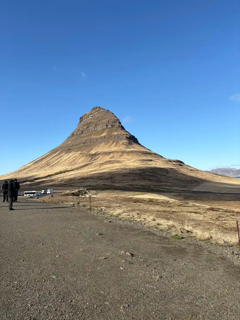
The mountain stands at a height of 463 meters (1,519 feet) and is one of the most photographed mountains in Iceland.[1] Its silhouette changes with every few steps you take around the car park, which is half the pleasure of a stop here: a blunt cone from one angle, a sharp blade from another, and from the waterfall path a neat fin against the sky. Photographers argue about the best spot, but the mountain is generous, and a short walk in either direction hands you a different mountain for the same effort.
Church Mountain: The Name and the Danish Sugar Loaf
The Icelandic name splits into two plain parts. Kirkju means church and fell means mountain, so Kirkjufell is simply Church Mountain. Stand on the village side and the comparison is easy to see: a steep roof, a narrow tower, snow sitting on the tiles. Farmers and fishermen have used the peak as a landmark for centuries, and nobody arriving by sea could miss it, which is probably why the name stuck instead of something more romantic. In winter the likeness is even sharper, when snow outlines every ridge and gully on the face.
Danish traders who worked these waters saw something sweeter in the profile and called it the sugar loaf, after the tall cones sugar was sold in. The nickname survives in old descriptions of the mountain, and it says something about how strongly the shape registers, even on people who sail past it year after year. Both names are attempts to describe the same thing: a peak that refuses to look like an ordinary mountain. Whichever name you prefer, you will recognise it instantly the first time it comes into view.

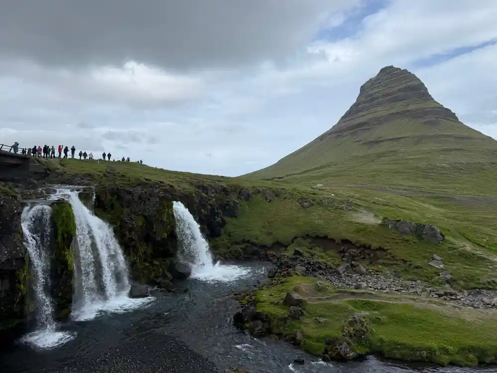
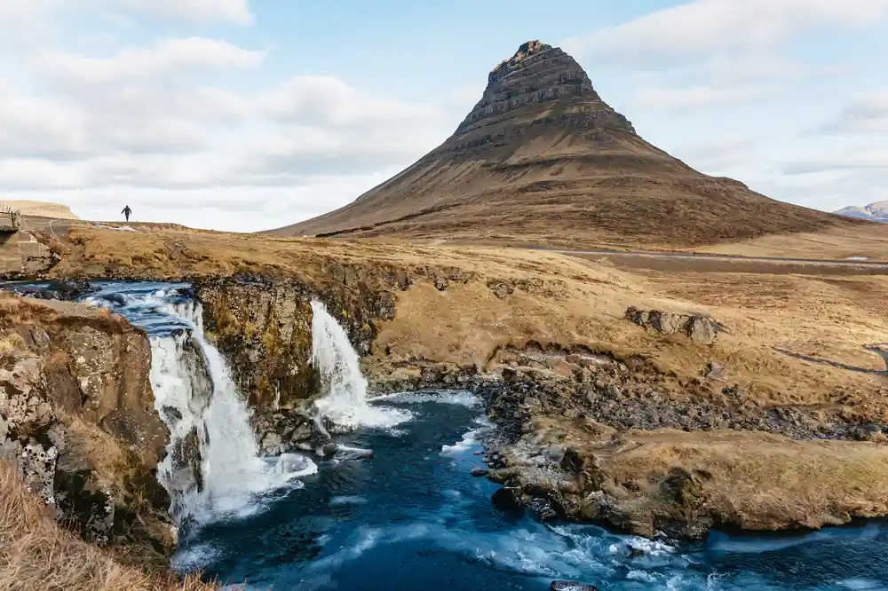
Kirkjufell above the falls, with the fjord and the village below.
Kirkjufellsfoss and the Grundarfjörður Waterfalls
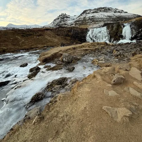
A short walk from the main road brings you to Kirkjufellsfoss, the Grundarfjordur waterfall that turns a roadside stop into a picture. Water slips over a rock shelf in two chutes and runs on toward the fjord, with Kirkjufell standing behind it. The path is easy and close to the parking, and the falls and the mountain fit into one frame without a long hike. In cold spells the edges of the falls glaze over, and the contrast between white water and dark rock is the reason so many people plan their whole day around this one stop.
Grundarfjordur waterfalls around the village are gentler than the big showpieces further south, and that is their charm: you hear the water, you see the whole peak, and there is room to stand still. If you are chasing a Snaefellsjokull waterfall frame, look west along the peninsula where meltwater drops off the lava fields toward the sea, though the glacier itself usually stays in the distance. Bring a cloth for spray, keep off the wet stones at the lip, and give yourself more time here than you think you need.
Screen Fame: Game of Thrones and The Secret Life of Walter Mitty
Kirkjufell has a second life on screen. In Game of Thrones it stood in for the Arrowhead Mountain beyond the Wall, a marker for characters heading into the snow, and the profile is unmistakable once you have seen it. The mountain also appears in The Secret Life of Walter Mitty, where the peninsula plays a wilder, emptier Iceland. None of this changes the place itself, but it explains the steady stream of visitors who arrive wanting one particular photograph of a peak they have already seen on a screen.
Fans come for the recognition, but the practical effect is simple: the car park at Kirkjufellsfoss fills quickly in summer, and the path gets busy when a coach pulls in. Arrive early or come back later in the day if you want the place to yourself. On a guided day tour the stop is part of the schedule, so the driving and the parking are handled for you, and you get a guide who can point out the angles and the small details that people walk straight past.
from US$145
The full-day tour from Reykjavik runs 11 hours, stops at Kirkjufell and offers free cancellation up to 24 hours in advance.[3]
Snaefellsnes Peninsula Photos: Light, Angle and Timing
This mountain rewards patience more than equipment. Midday light flattens the ridges; low sun rakes across them and shows the layers. In winter the peak often wears a cap of snow while the fields below stay green or black, and the long summer evenings mean an after-dinner stop can be the best of the day. Cloud moves fast here, so a summit that looks lost when you arrive can clear while you are still setting up. A wide lens suits the falls, a longer one picks the summit out from the village, and a polarising filter helps on bright days.
For classic Snaefellsnes peninsula photos, stand on the far bank of the falls, drop low, and let the water run across the bottom of the frame with the peak above it. A tripod and a cloth for spray help. Wind is the usual enemy, so keep a hand on your hood and a spare cloth in your pocket. If you only carry a phone, that is fine: the composition does the work, and the mountain fills the frame from almost anywhere on the path. The weather on the peninsula is overall quite good throughout the year, but it can change quickly, so have a flexible plan.[7]
Climbing Kirkjufell: Risk, Route and Reality
A route leads up Kirkjufell, but it is not a casual stroll. The lower slope is steep grass and loose scree, and higher up the rock is exposed, with drops that feel sharper than they look from the road. There are no handrails, no signs of a groomed trail and no easy way down once the ground is wet. Even parties that start early can find themselves in cloud halfway up, with no view and slick rock underfoot. People in trainers on a damp day usually turn around early, which is the sensible outcome.
If you want the summit, ask locally about conditions and go with someone who knows the line, with proper boots and a clear forecast. Everyone else is better off below, where the falls, the fjord and the mountain arrange themselves without any scrambling. The view from the ground is the one on the postcards anyway, and you keep your energy for the rest of the peninsula. Climbing is a choice, not a requirement, and the mountain does not look smaller because you stayed at the bottom.
Visiting Kirkjufell: What to Expect and Prepare For
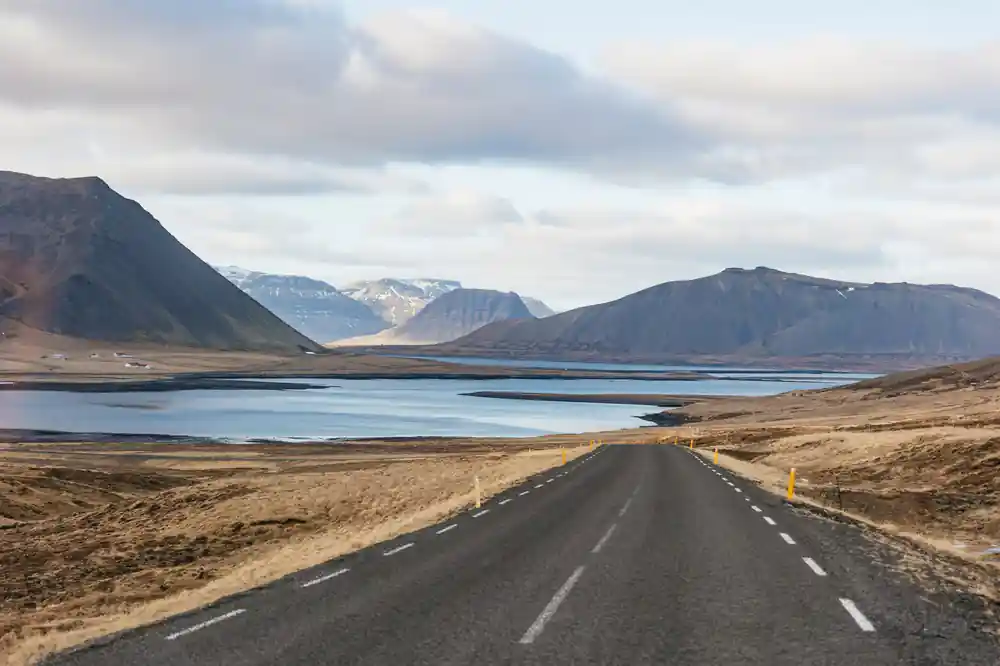
The Snæfellsnes Peninsula sits 136 km (85 mi) from Reykjavík, roughly a 2-hour drive via Route 1 and Route 54.[2] Kirkjufell is one of the stops on the From Reykjavik: Snæfellsnes Peninsula Full-Day Tour, which runs 11 hours, starts from US$145 and offers pickup.[3] The road crosses farmland, lava fields and a mountain pass before the peak appears on the north coast, and there is a stop at the falls for photographs.
Dress for a coastal day: warm layers, a windproof and waterproof shell, and shoes with grip for wet gravel and black sand. Bring water and snacks; stops are short and you will want to keep moving when the light is good. The tour offers reserve now and pay later, and free cancellation up to 24 hours in advance.[3] Sunglasses help when low sun bounces off water, and a spare battery is never wasted on a day this long.
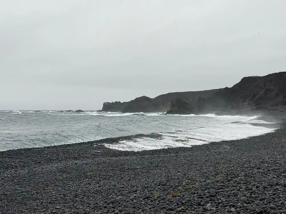
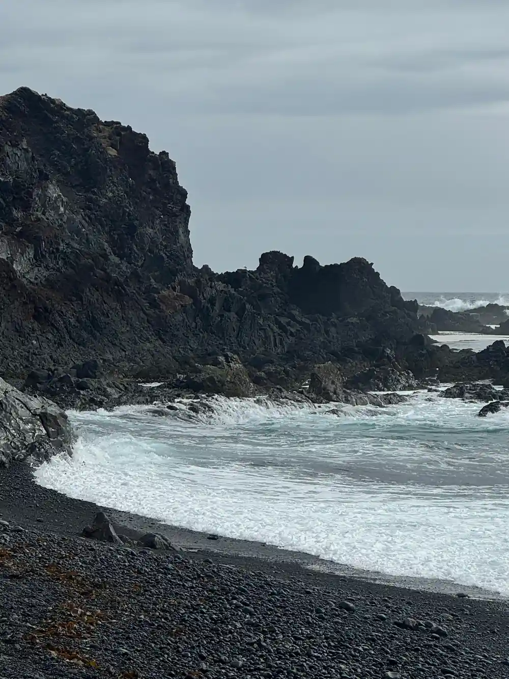
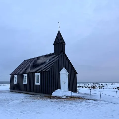
The rest of the day fills in the peninsula. Búðakirkja is a small wooden church on the south side,[8] and Djúpalónssandur is known for its four historic lifting stones, the remains of the British trawler Epine GY7 wrecked in 1948, the natural rock arch Gatklettur and its black pebble beach.[9] Near Arnarstapi, a small easy trail starts close to the Bardur statue and takes about 2 hours return along the coastline.[10] Snæfellsjökull is 1,446 meters high, and Snæfellsjökull National Park was established in 2001.[4]
Full-day Snaefellsnes tour prices from Reykjavik
Each bar is a from-price stated by its listing.[3][5][6][11]
What a Snaefellsnes day costs
US dollar from-prices of these listings.[3][5][6][12]
When to visit Kirkjufell
Photographing Kirkjufell
Reach the falls
Walk from the car park to Kirkjufellsfoss. It is short and easy, and the mountain lines up behind the water.
Frame the shot
Stand on the far bank, get low, and let the falls run across the bottom of the frame with the peak above.
Watch the light
Midday flattens the ridges. Early and late light brings out the shape, and a gap in the cloud is worth waiting for.
Walk the loop
Follow the path around the falls for a second angle, then try the village side for the church-like profile.
Keep it safe
Stay back from wet rock at the lip and hold onto hats and tripods when the wind picks up.
See Kirkjufell on a full-day tour from Reykjavik
from US$146Reserve now & pay later