In a nutshell
- Lava fields, old farm sites, sea cliffs and a small wooden church all carry names out of the sagas. The peninsula is compact enough to read its stories in a single day.
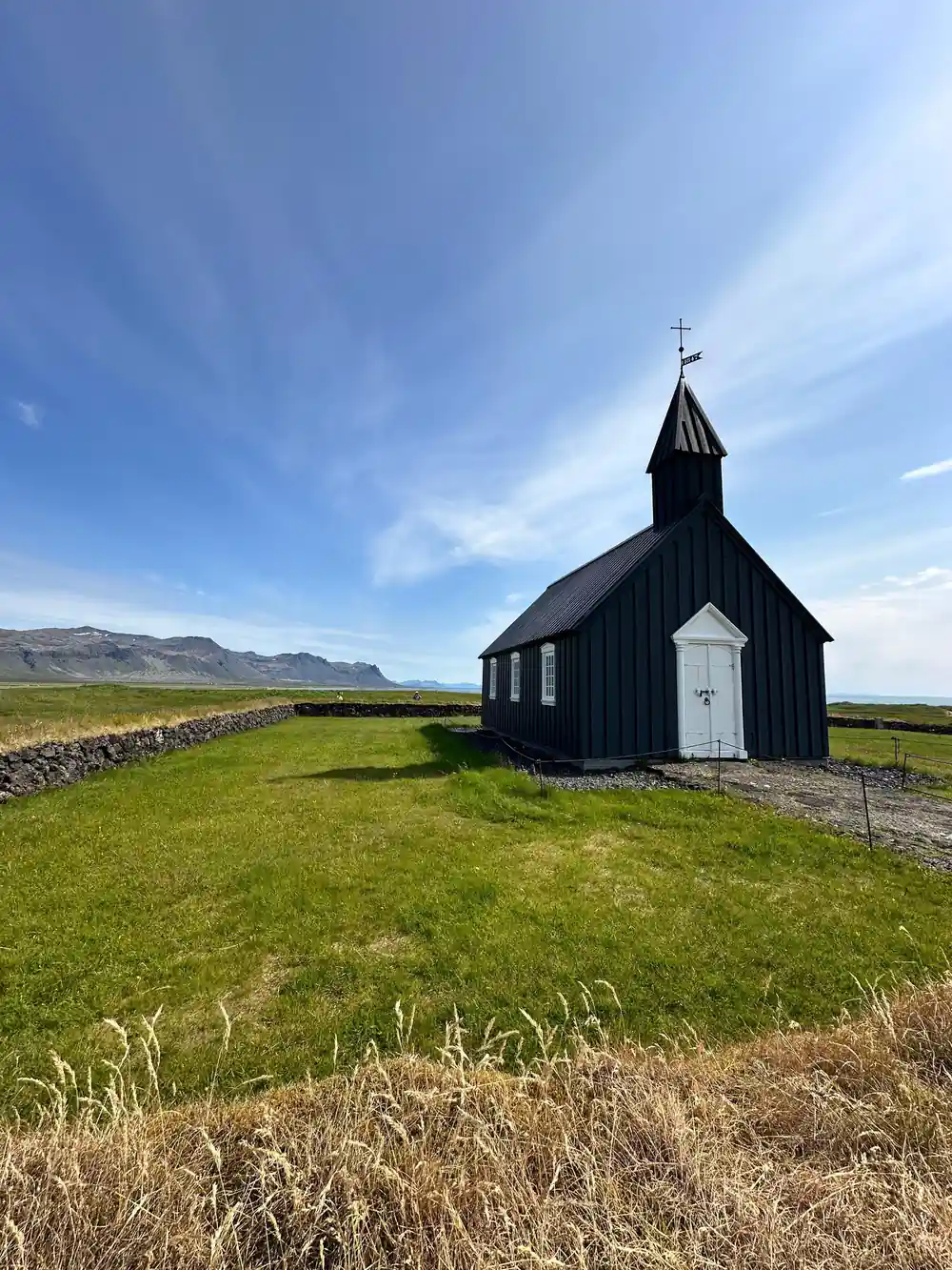
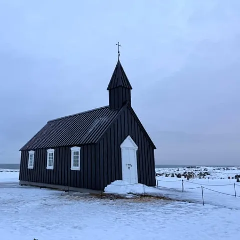
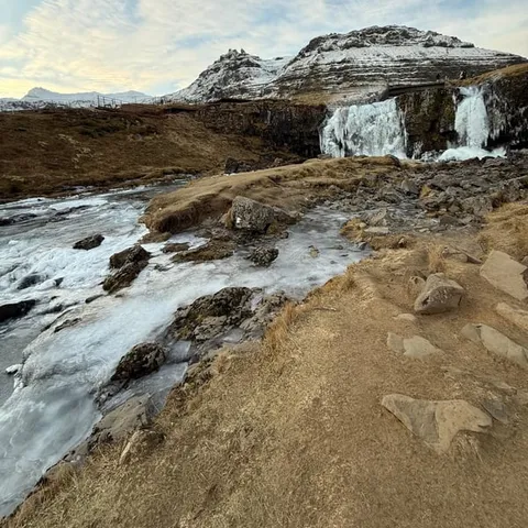
- Kirkjufell, the black pebble beach at Djúpalónssandur, the sea cliffs at Londrangar, the coast at Arnarstapi and Búðakirkja, a small wooden church on the south side.
- The full-day tour from Reykjavik runs 11 hours, from US$145, with pickup available, a live English-speaking guide and free cancellation up to 24 hours in advance.[1]
- Weather on Snæfellsnes is overall quite good throughout the year, but it can change quickly, so a flexible travel plan is a good idea, especially in winter.[2]
- The peninsula sits 136 km (85 mi) from Reykjavík, roughly a 2-hour drive via Route 1 and Route 54.[3]
- Top choice Full-Day Snaefellsnes Tour from US$145 Rating4.72 from 3,765 reviews[1]Duration11 hours[1]PickupCheck availability for pickup options[1]CancellationCancel up to 24 hours in advance[1] Check availability
- Premium Minibus Tour from US$161 Rating4.77 from 789 reviews[4]Duration11 hours[4]PickupCheck availability for details[4]CancellationCancel up to 24 hours in advance[4] See this tour
- Small-Group Peninsula Tour from US$138 Rating4.60 from 478 reviews[5]Duration12 hours[5]PickupCheck availability for details[5]CancellationCancel up to 24 hours in advance[5] See this tour
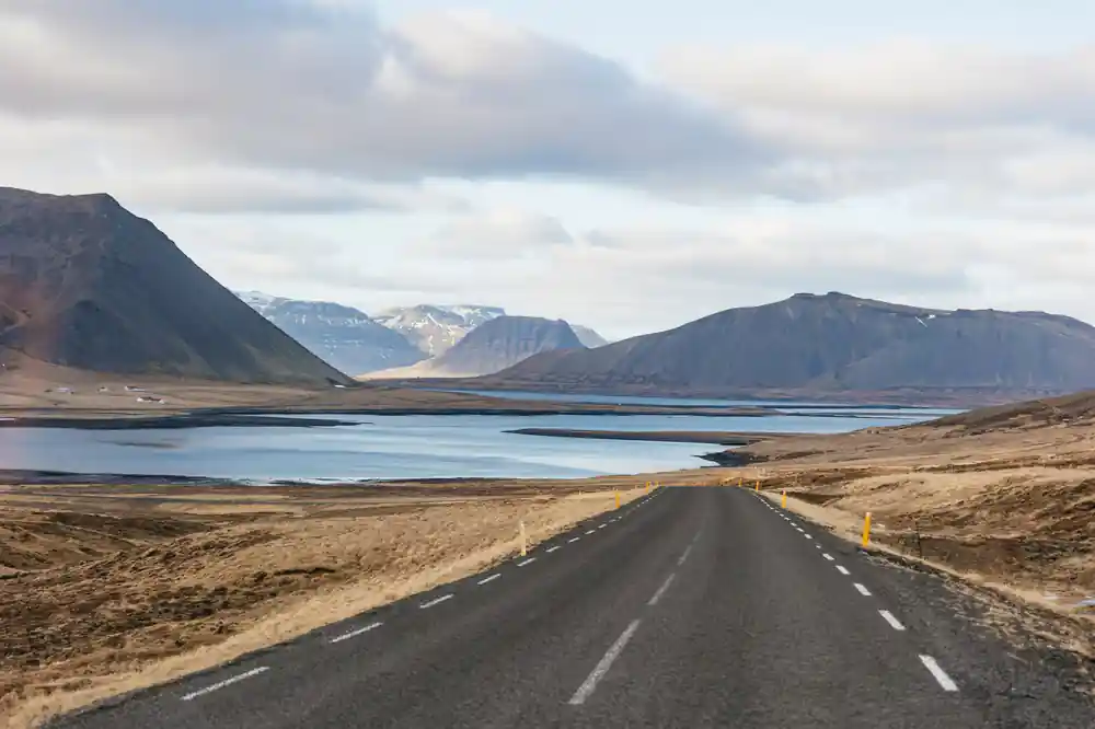
Bárður was, according to Bárðar Saga Snæfellsáss , the settler of this area, half a troll, and half a man; his father was half a titan, but his mother was human.
Worth it for the stories and the lava
Things to check
What to pack and how to move
- Windproof and waterproof layers, plus a warm hat
- Sturdy shoes for gravel, lava rock and wet paths
- Sunglasses and sunscreen for bright coastal light
- Pickup is available; check the options when you book[1]
The Berserkers' Path Across Berserkjahraun
Berserkjahraun is a lava field on the northern side of the peninsula, and its name does the work of a whole chapter. Hraun means lava, and the berserkers were the two brothers the old story places here: men whose strength was useful until it became frightening, and whose fate was settled with impossible tasks and a road cut through the rock. Standing at the edge of the field now, with moss filling every crack and the sea somewhere beyond the ridge, it is easy to see why a story this dark attached itself to ground this broken.
The lava is the reason the story stayed here rather than somewhere else. Rough, ropy and cooled in folds, it is ground that resists walking, farming and building alike, and the paths across it stay narrow and few. A track that people remember and give a name to is a rare thing in a field like this, and the name has stuck to the whole flow. Look for the low moss-covered humps and the shallow hollows where the surface has collapsed over old lava tubes. The colour shifts with the weather, grey in rain and almost green in low sun.
Lava that cooled slowly beneath a crust looks different from lava that cooled quickly in open air. Here you get both, smooth ropy surfaces in one place and jagged broken edges in another, with moss that takes a long time to build a mat thick enough to walk on. Stay on the marked paths and the ground stays intact under your boots.
Eyrbyggja Saga and Snorri goði at Helgafell
Eyrbyggja Saga belongs to this peninsula the way few sagas belong to anywhere. Its pages hold the everyday machinery of a settlement: land claims, marriages, lawsuits, the slow build of feuds between neighbouring farms, and chieftains who solve problems with a mixture of law, force and patience. At the centre stands Snorri goði, a man the saga remembers as careful, calculating and long-lived. Helgafell, the small hill the story ties to him, is one of those places where you can put a finger on the map and feel the saga settle.
What makes the saga unusual is the company it keeps. Alongside the lawsuits there are disappearances, dreams, a dead man who will not stay in his grave, and a series of hauntings that a household deals with in a very practical, almost administrative way. The uncanny arrives in the same tone as a boundary dispute. Read it with a map open and the northern shore becomes a set of addresses rather than scenery: farm sites, church sites, a hill, a headland, a place where two families stopped speaking.
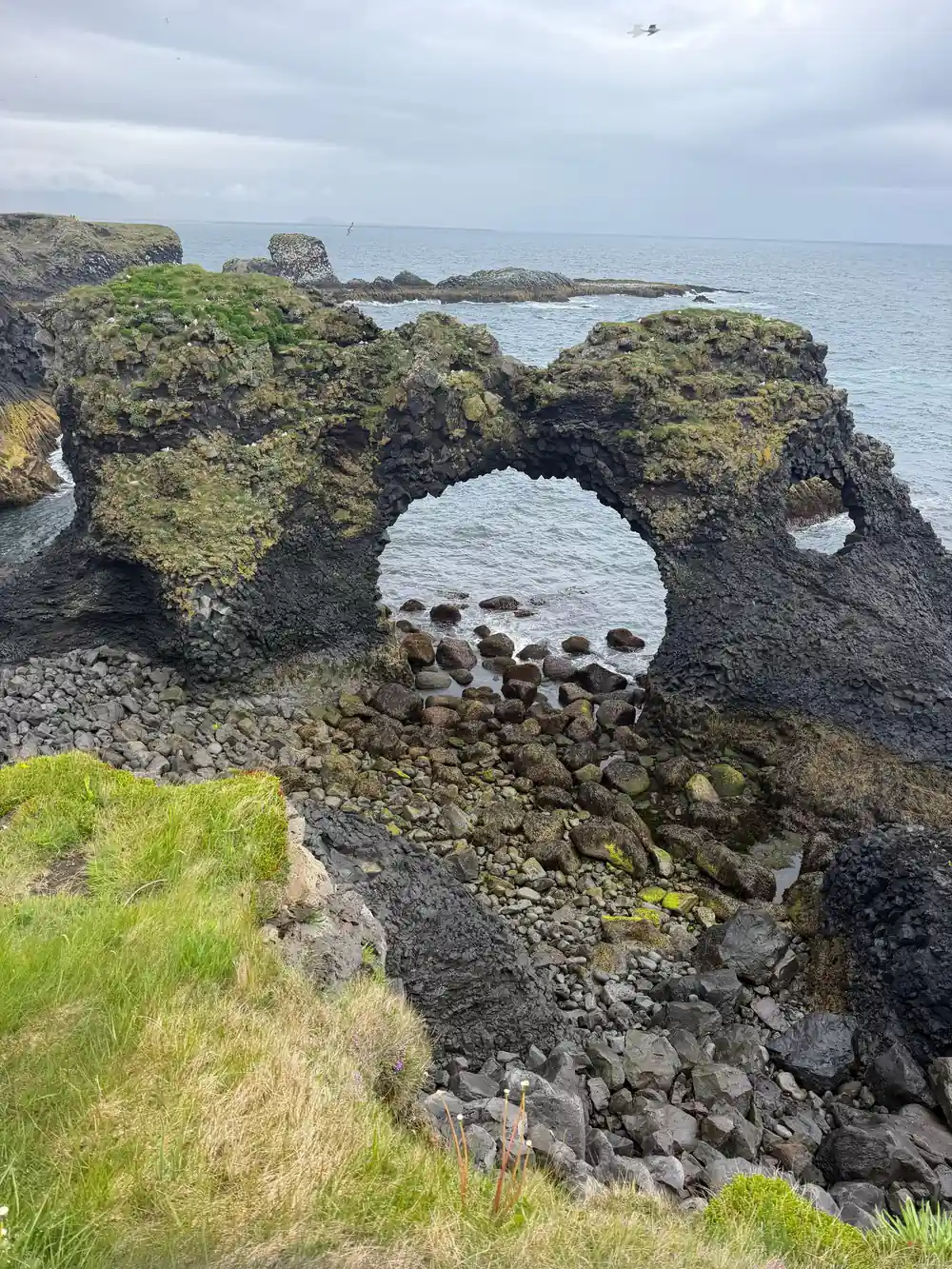
Mossy lava, a road that bends around it, and a glacier on the horizon.
Guðríður's Voyage from Laugarbrekka to Vinland
The sagas send Guðríður Þorbjarnardóttir out from a farm at Laugarbrekka on the southern edge of the peninsula, and they do not keep her at home. She marries, she sails west with the ships that were looking for new land, she spends time in the place the sagas call Vinland, and later she travels south, further than her neighbours would ever go. The stories treat her as a person with a say in her own life, and the peninsula keeps her name in the landscape.
Laugarbrekka sits near the south coast road, not far from the cliffs at Hellnar and Arnarstapi. Her story starts within sight of the sea she eventually crossed. That is the shape worth holding in your head as you drive this side of the peninsula: a farm, a shore, a boat, a horizon. The coast walk from Arnarstapi is also where the Bardur statue stands, so the settler and the traveller sit close together on the same stretch of path.[6]
If you are travelling with children, her story is the easiest one to tell out loud: a woman who left a farm on this coast and ended up on the far side of the Atlantic. The stops on the south side of the peninsula are close enough together that you can tell it between two of them.
Survival on an Exposed Coast
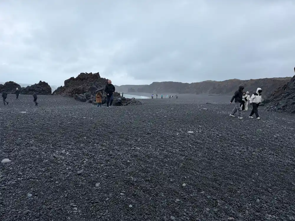
Sagas are about people, but this coastline works to the sea's terms. Fishing, drying, collecting driftwood and watching the weather were the ordinary work of households along the shore, and the sea took its payment regularly. At Djúpalónssandur the record is unusually visible. The black pebble beach sits at the foot of the Snæfellsjökull glacier, and on it are four historic lifting stones, the natural rock arch Gatklettur, and the remains of the British trawler Epine GY7, wrecked there in 1948.[7]
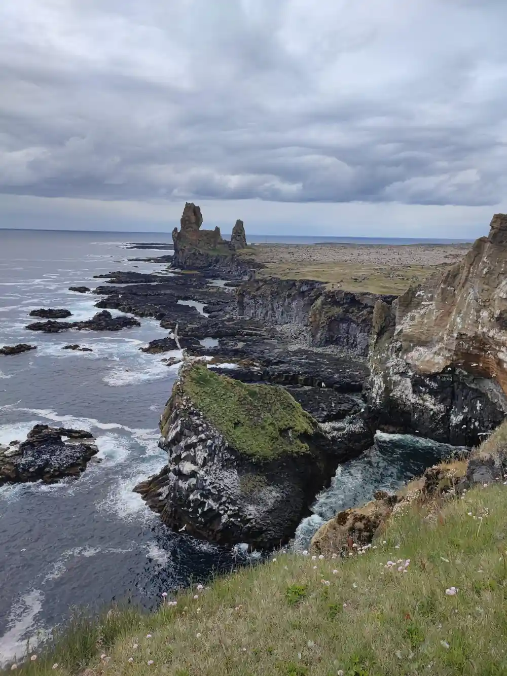
Londrangar is the other place where the coast shows its teeth: basalt stacks standing off the shore with cliffs around them. Puffins nest at Londrangar from late spring to summer, and the cliffs are loud with birds through the warmer months.[8] The walk from Arnarstapi to Hellnar follows the same coast, starting very close to the Bardur statue and taking about 2 hours return along an easy trail.[6] Between the two villages the path passes basalt columns and rock arches, and the birds are overhead the whole way.
from US$145
The full-day tour runs 11 hours, with pickup available, an English-speaking guide and free cancellation up to 24 hours in advance.[1]
Human Names and the Hidden People of the Lava
Place names here are a register of who lived on this coast and what they believed. Farms carry personal names from the settlement, stacks and cliffs carry descriptions of their shape, and the lava fields carry stories. Some of those stories belong to the hidden people. Belief in huldufólk and elves attaches itself to particular rocks, clefts and boulders, and the old habit was not to argue with them: you left the rock alone, you did not move the stone, and if a road bends around a boulder there was often a reason that had nothing to do with engineering.
Bárður Snæfellsás is the figure who gathers much of this together. As the saga tells it, he was the settler of the area, half a troll and half a man, with a half-titan father and a human mother.[9] The Bardur statue at Arnarstapi stands near the start of the coastal walk.[6] Búðakirkja, a small wooden church on the south side of the peninsula, is another place where a name, a building and a story sit together on the map.[10]
You do not have to believe any of it to notice how it works. A story attached to a rock makes people walk around the rock, and a landscape that has been walked around for centuries keeps its shape in ways that a cleared field does not.
Reading the Sagas in the Landscape Today
You do not need to be a scholar to enjoy this. A paperback of one saga, read on the bus or in the evening after a day out, changes what you notice: a boundary wall, the site of a farm, a hill someone was buried in. The peninsula rewards that kind of attention because the distances between the settings are short and the places come one after another along the same road.
Weather is the one thing to plan around. On Snæfellsnes the weather is overall quite good throughout the year, but it can change quickly, so a flexible travel plan is a good idea, especially in winter.[2] Windproof layers, waterproof boots and spare gloves make more difference than any amount of forward planning.
If you want to get inside the geology rather than look at it, the guided Vatnshellir lava cave tour lasts 45 minutes and takes you under the surface of the peninsula.[11] That is a short stop, and a good counterweight to a day spent looking at the outside of the same rock. For a different pace altogether, Stóri-Kambur offers horse riding tours that take riders into the heart of Snæfellsnes in West Iceland.[12]
Planning a Day Among the Snæfellsnes Peninsula Lava Fields
The peninsula sits 136 km (85 mi) from Reykjavík, roughly a 2-hour drive via Route 1 and Route 54.[3] A full-day tour from Reykjavik runs 11 hours, with pickup available and a live English-speaking guide, and you can reserve now and pay later.[1]
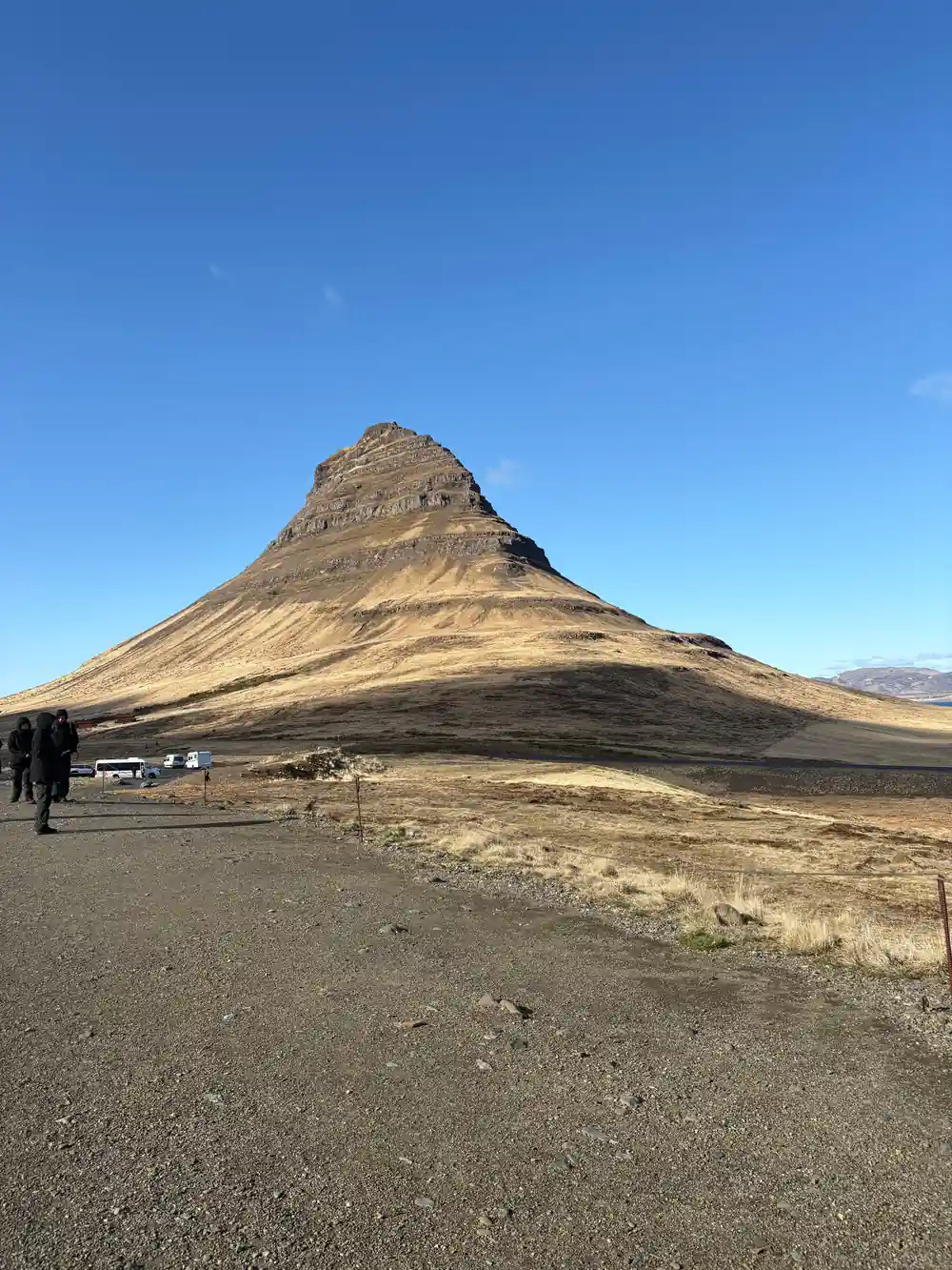
The listed stops on that tour include Vatnaleið, Kirkjufell, Ólafsvík, Djúpalónssandur, Londrangar, Arnarstapi, Búðakirkja and Ytri Tunga, with 28 drop-off locations at the end of the day.[1] Kirkjufell stands 463 meters (1,519 feet) tall and is one of the most photographed mountains in Iceland.[13] Free cancellation up to 24 hours in advance for a full refund.[1]
Prices start from US$145, and the tour is rated 4.72 from 3,765 reviews, with 4.8 for the guide.[1] If you are driving yourself, the same coast makes a long but manageable day. If you would rather read about berserkers than watch the road, the coach is the easier choice.
Distances from Hotel Snæfellsnes
Road distances in kilometres from Hotel Snæfellsnes, in the middle of the peninsula, to each of these places, as given in the hotel's own listing.[14]
Compare tour prices per person
US dollar from-prices of these GetYourGuide listings.[1][4][5][15]
When to go to Snæfellsnes
How to plan a saga day
Read one saga first
Read one of the peninsula sagas before you travel. Even a short retelling gives the lava fields names, families and grudges.
Fix your dates and book
Book the full-day tour and use reserve now, pay later if you want room to change plans; cancellation is free up to 24 hours in advance.[1]
Pack for four seasons
Coastal weather changes quickly here, so bring windproof and waterproof layers, sturdy shoes for gravel and lava rock, and a hat that will stay on.
Know the drive
The peninsula sits 136 km (85 mi) from Reykjavík, roughly a 2-hour drive via Route 1 and Route 54.[3]
Save time for the stops
Kirkjufell, Djúpalónssandur, Arnarstapi and Búðakirkja are all listed stops on the full-day tour.[1]
See the lava fields and the saga places in one day
from US$146Reserve now & pay later